

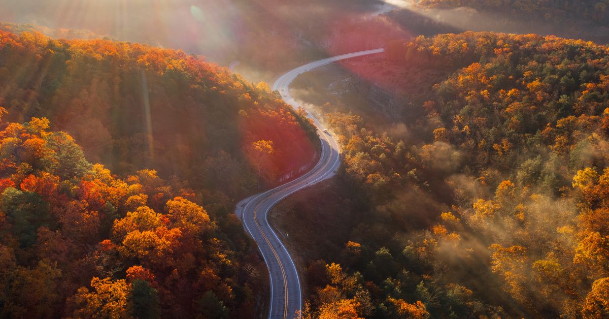
The morning air is feeling a bit crisper and the days are getting shorter, which can only mean one thing: the Ozarks are about to be set ablaze with the burnt oranges, deep reds, and vibrant yellows of Autumn! With countless trails begging to be explored, we’ve compiled a list of some of our favorite fall hikes.
Below, you will find eight hiking adventures with some of the best leaf peeping angles in the region. We picked dog-friendly locations with easy to moderate difficulty so that everyone and their furry friends can get out and enjoy this quintessential Northwest Arkansas activity.
If you are bringing your dog, don’t forget to bring something to pick up after them! Let’s help keep #NWArk beautiful and #LeaveNoTrace
Sam’s Throne
Sam’s Throne Trail is a moderately trafficked, 2-mile loop trail located near Mount Judea, Arkansas. Sam’s Throne is a well-known rock climbing site with short trails leading down to the bluff edge where you will find breathtaking views of Big Creek valley. Fun fact: the surrounding area contains over 100 named climbing routes of various difficulty levels.
Tanyard Creek Loop
Tanyard Creek Loop is a 2.2 mile heavily trafficked loop trail located near Bella Vista, Arkansas that features a waterfall and is good for all skill levels. The trail is dog-friendly, and even has a dog watering fountain at the beginning of the trail, but they must be leashed.
This is a perfect scenic hike for all ages in quick proximity to anyone living in Northwest Arkansas. Follow the trail signs down and through the forest about a mile and you will arrive at the Tanyard Creek Falls.
Lake Loop Trail (Lincoln Lake)
Lake Loop Trail is a 4.3 mile lightly trafficked loop trail west of Fayetteville near Lincoln, Arkansas that features a river and is rated as moderate. The trail is primarily used for hiking, running, and mountain biking. Dogs are also able to use this trail but must be kept on a leash.
Hikers, boulderers and rock climbers will enjoy multiple stunning views of the lake and several large, beautiful moss-covered rock formations. In addition to the loop, there are multiple exploration-worthy overlooks. Note: some users report parts of the trail can be difficult to pass when flooding, so it is best to skip this one after heavy rain.
Yellow Rock
Ol’ Yellow Rock! Yellow Rock Trail is a 3.1-mile loop trail located in Devil’s Den State Park near West Fork, Arkansas. The Yellow Rock Overlook sits 300 feet above the valley and offers a panoramic view of the Lee Creek Valley. This trail has several nice rock formations and is rated as moderate. Built in the 1930’s, it has been primarily used for hiking, but we encourage sturdy shoes since it is still quite rocky. Heads up, this one is often busy on the weekends, so plan this adventure during the week if you can.
Alum Cove Natural Bridge Trail
Alum Cove Trail is a 1.2 mile heavily trafficked loop trail located near Deer, Arkansas that features a river and is rated as moderate. The trail offers a number of activity options and is accessible year-round. Dogs are also able to use this trail but must be kept on leash.
At 130 feet long and 25 feet wide, this trail leads down to one of the largest natural bridges in this part of the country before looping out to a bluff line. And while the hike is relatively short, there is no shortage of beautiful views to take in including the caves and waterfalls along the bluff on the far end of the loop
Pedestal Rocks Loop (+Kings Bluff)
Named for its really cool rock formations, the Pedestal Rocks Loop Trail is a 2.2-mile moderately trafficked hike located near Sand Gap, Arkansas. Once you finish viewing the rock formations from atop the bluffs, be sure to hike down below the bluffs to check out several of the walk-through caves. The net elevation change on this one is about 250 feet. If you finish with enough daylight, check out the King’s Bluff Loop Trail located right next to it.
Whitaker Point
Whitaker Point Trail is located near the little town of Deer, Arkansas. Often referred to as Hawksbill Crag, this one is a 2.9-mile lightly trafficked out and back trail that features a waterfall and is rated as moderate. The “Crag”, a rock formation that juts out from the bluff’s face, received its name because it resembles a hawk’s beak. It overlooks Whitaker Creek and a huge valley stretching out into the distance. A bit tougher to reach than the others, we recommend hikers take a 4-wheel drive vehicle up to the trailhead. That said, the drive is sooo worth it!
King’s River Overlook Trail
King’s River Overlook Trail is a 1.2 mile moderately trafficked out and back trail located near Huntsville, Arkansas that features a river and is good for all skill levels. The trail is primarily used for hiking, running, nature trips, and bird watching and is accessible year-round. Dogs are also able to use this trail.
Offering one of the most awe-inspiring, birds-eye views of the river, the Kings River Overlook Trail is a short, family-friendly hike perfect for peeping the fall foliage. After a rain, you might want to check out Eagle’s Nest Falls by following a side spur down the bluff—just make sure you have sturdy hiking boots and take it slow and steady, it’s a little challenging.
Bonus
If you want to skip the hikes and go straight for some views, see: the overlook at Mt. Sequoyah in Fayetteville, White Rock Mountain near the Mulberry River, the Pig Trail Overlook off of HWY 23, Inspiration Point near Eureka Springs, Kyle’s Landing at the Buffalo National River and the Arkansas Grand Canyon located along HWY 7, near Jasper, Arkansas.